THE BOWTIE
Fostered through a series of collaborative workshop events with neighboring community members of all ages and backgrounds, The Bowtie analysis and concept plan was born out of responses from almost 2,000 community members who have been eager to reclaim this valuable 18-acre parcel for their park-deficient district, with ambitions to transform it into a vibrant nature park.
Due to the adjacent construction of the railroad and subsequent channelization of the Los Angeles River in the 1930s, the surrounding neighborhoods and Angelenos at large have been left disconnected from this vital riverfront for more than a century. While the property was purchased for public park use almost twenty years ago, it has mostly remained a post-industrial landscape, partially covered with concrete, contaminated soil, and invasive vegetation. Upon execution of the proposed ecologically-focused and community-driven concept plan - which was created in collabaoration with California State Parks, Clockshop, and RADAR - the revitalized area will support flora and fauna that are native to the river, in addition to offering historical, cultural, and nature-based educational programming and passive recreational opportunities that will be accessible and welcoming to all.
While the parcel has remained a mostly undeveloped and post-industrial site since its public acquisition, many neighbors still found ways to make it their own. Much of the interim programming was facilitated by Clockshop, a local multi-disciplinary arts organization that seeks to generate social change through the transformation of public space, and they have since served as valuable and integral project team partners for our concept design. Today, the site is used very informally, primarily by youth who seek refuge in the quiet isolation of the space. Bicyclists also often use it to connect from the adjacent utility access road to the surrounding neighborhoods. These activities, while officially unsanctioned, provide evidence of the strong ties and feeling of ownership that the surrounding community has for this site.


Concept Rendering


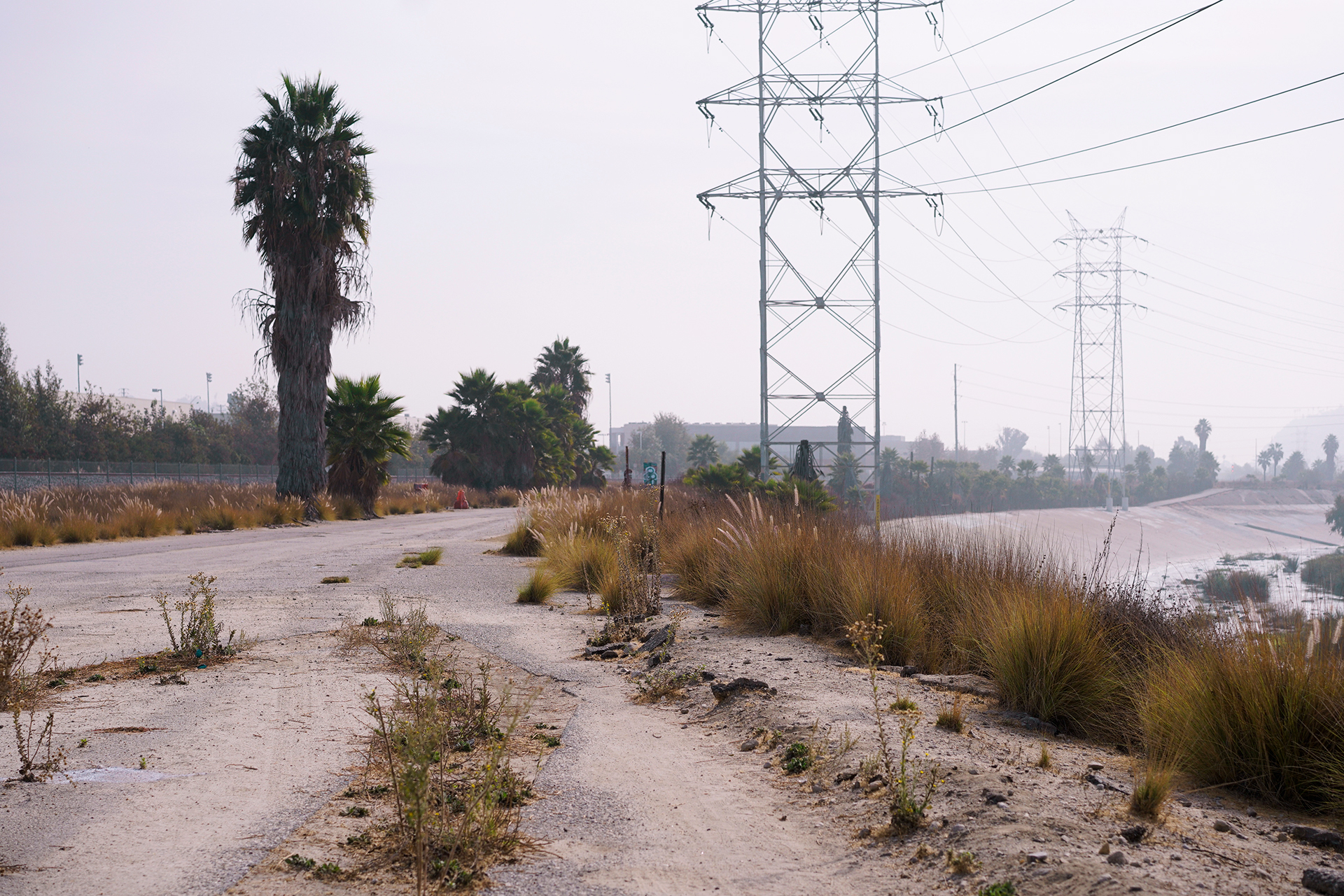
Existing Site
Site History
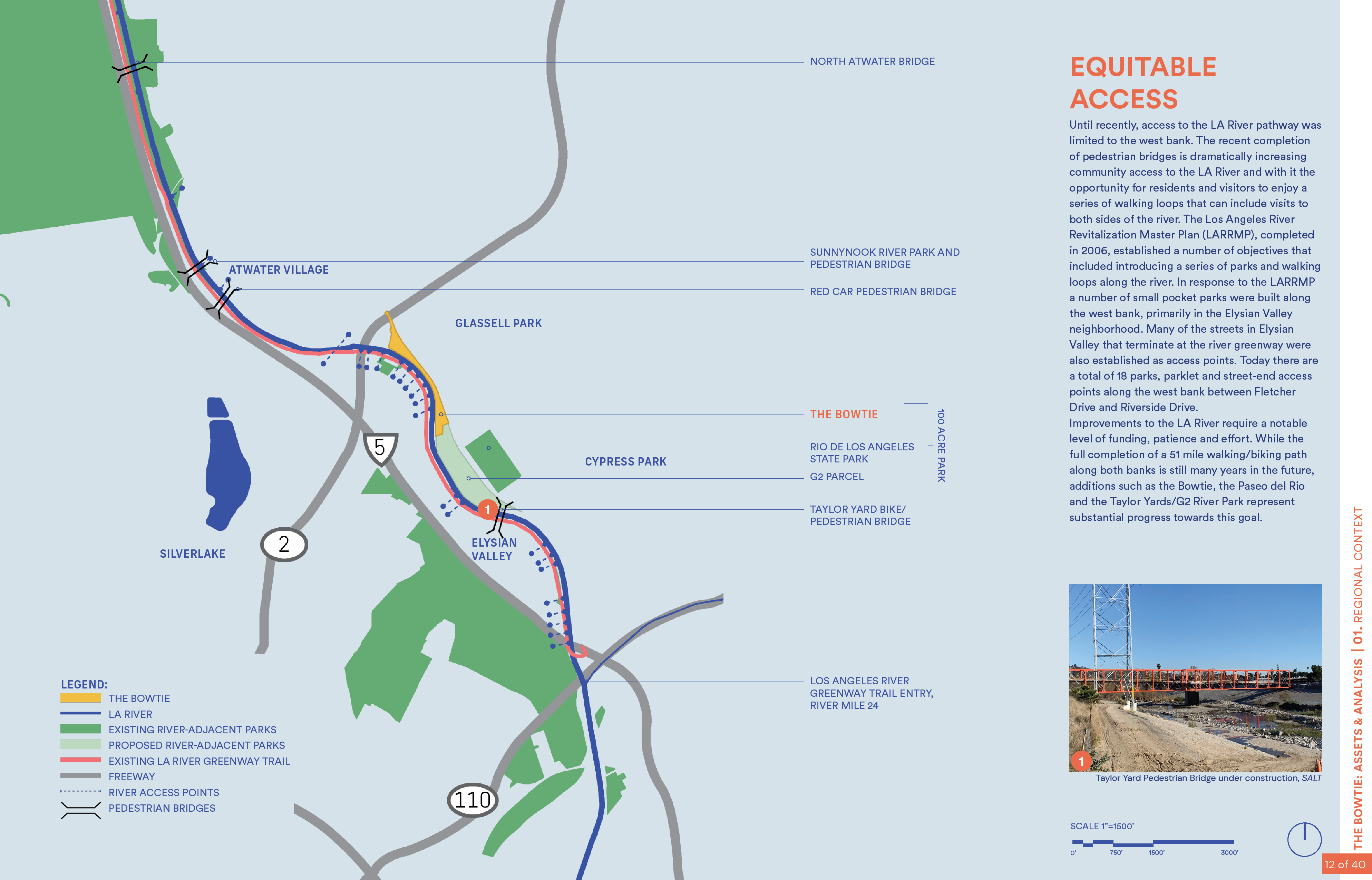
For over twenty years, efforts have been underway to restore and reactivate 51-miles of waterway called Rio de Los Angeles, also known as the Los Angeles River, which runs through some of the most populated and park-barren neighborhoods in Los Angeles. Centuries prior, the land was home to the Gabrielino-Tongva, near their village of Yaanga, one of the largest villages in the region for these indigenous people. In the late 1700s, European settlers took over the land for agriculture and industry. Much of the riverfront was claimed for industria operations in the 1920s, including a large parcel in northeast Los Angeles that served as the headquarters for Southern Pacific Railroad. After operations ceased in the 1980s, the State purchased a selection of parcels for park programming. In total, 100-acres were reclaimed for public use, including the 18-acre Bowtie parcel, as part of a grand partnership between California State Parks, the City of Los Angeles, and Mountains and Recreation Conservation Authority.
For over twenty years, efforts have been underway to restore and reactivate 51-miles of waterway called Rio de Los Angeles, also known as the Los Angeles River, which runs through some of the most populated and park-barren neighborhoods in Los Angeles. Centuries prior, the land was home to the Gabrielino-Tongva, near their village of Yaanga, one of the largest villages in the region for these indigenous people. In the late 1700s, European settlers took over the land for agriculture and industry. Much of the riverfront was claimed for industria operations in the 1920s, including a large parcel in northeast Los Angeles that served as the headquarters for Southern Pacific Railroad. After operations ceased in the 1980s, the State purchased a selection of parcels for park programming. In total, 100-acres were reclaimed for public use, including the 18-acre Bowtie parcel, as part of a grand partnership between California State Parks, the City of Los Angeles, and Mountains and Recreation Conservation Authority.


Collaborating with the
Community
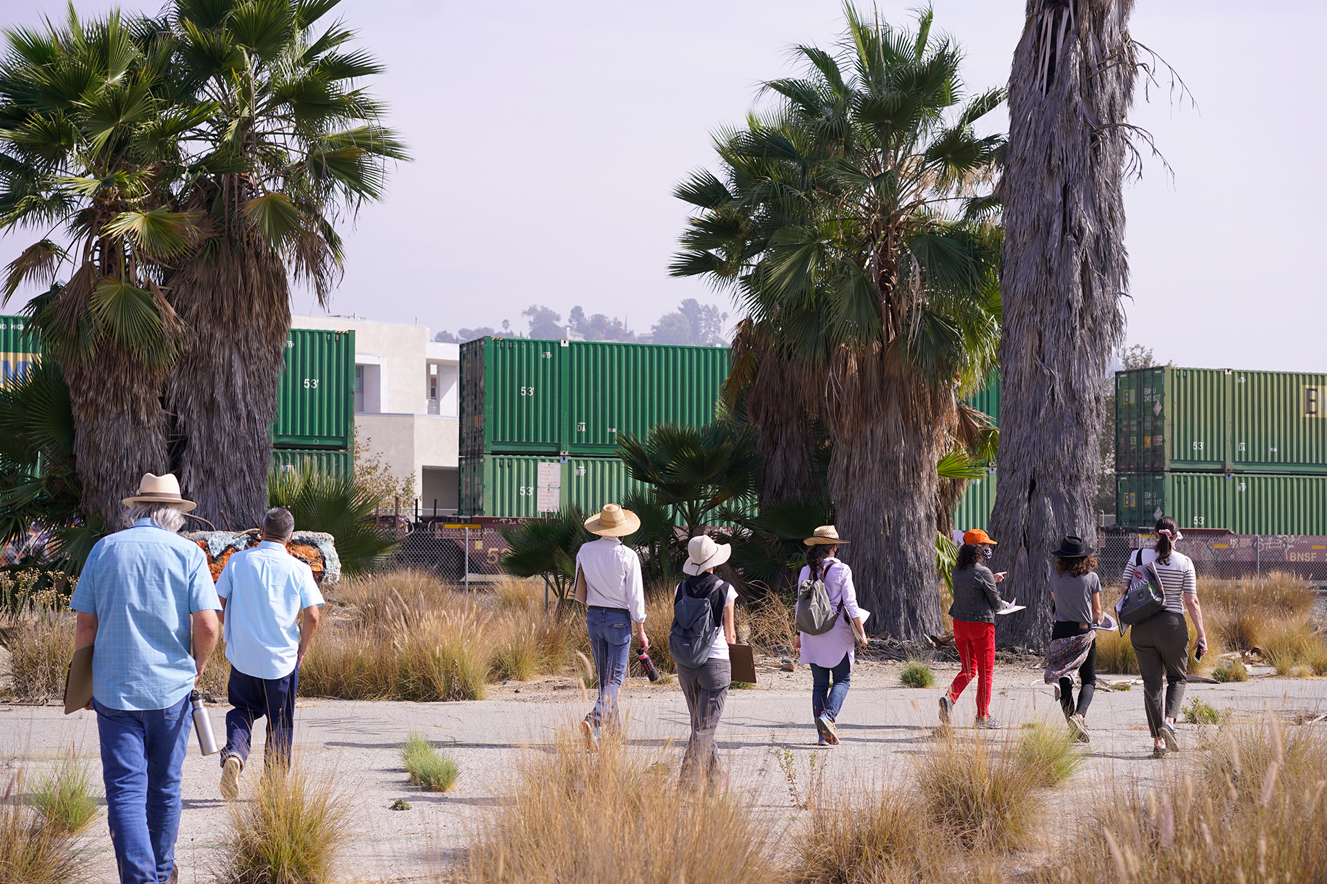
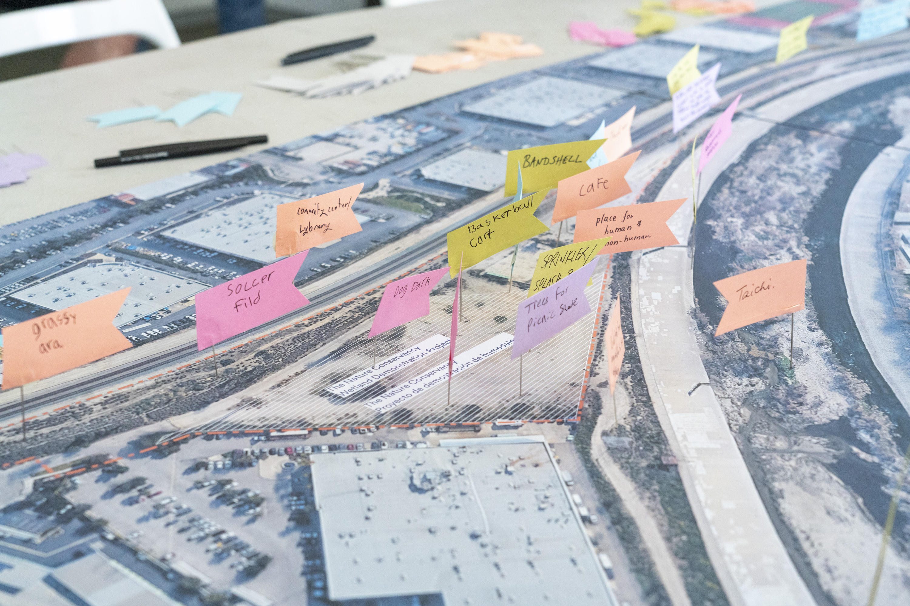
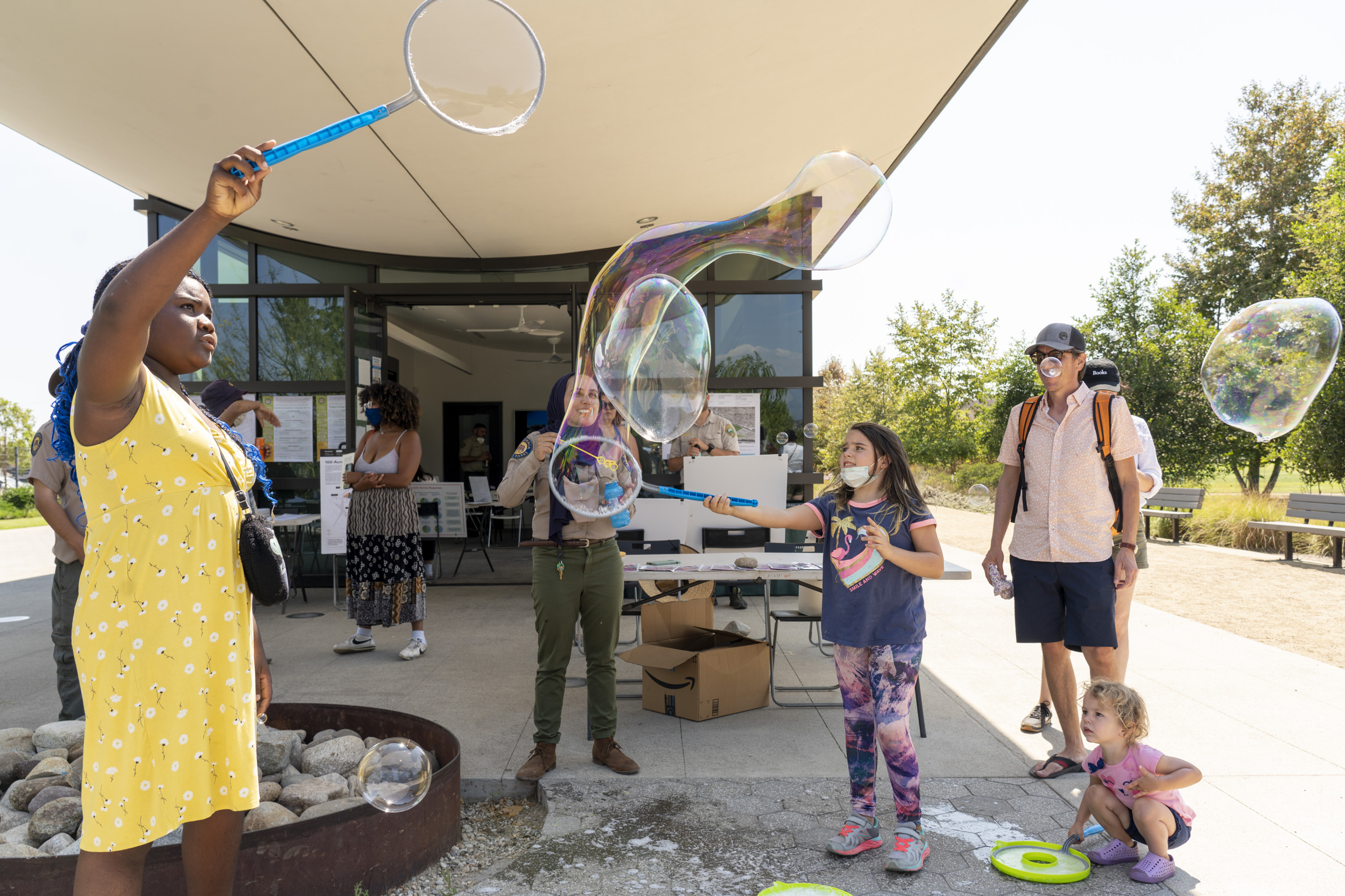
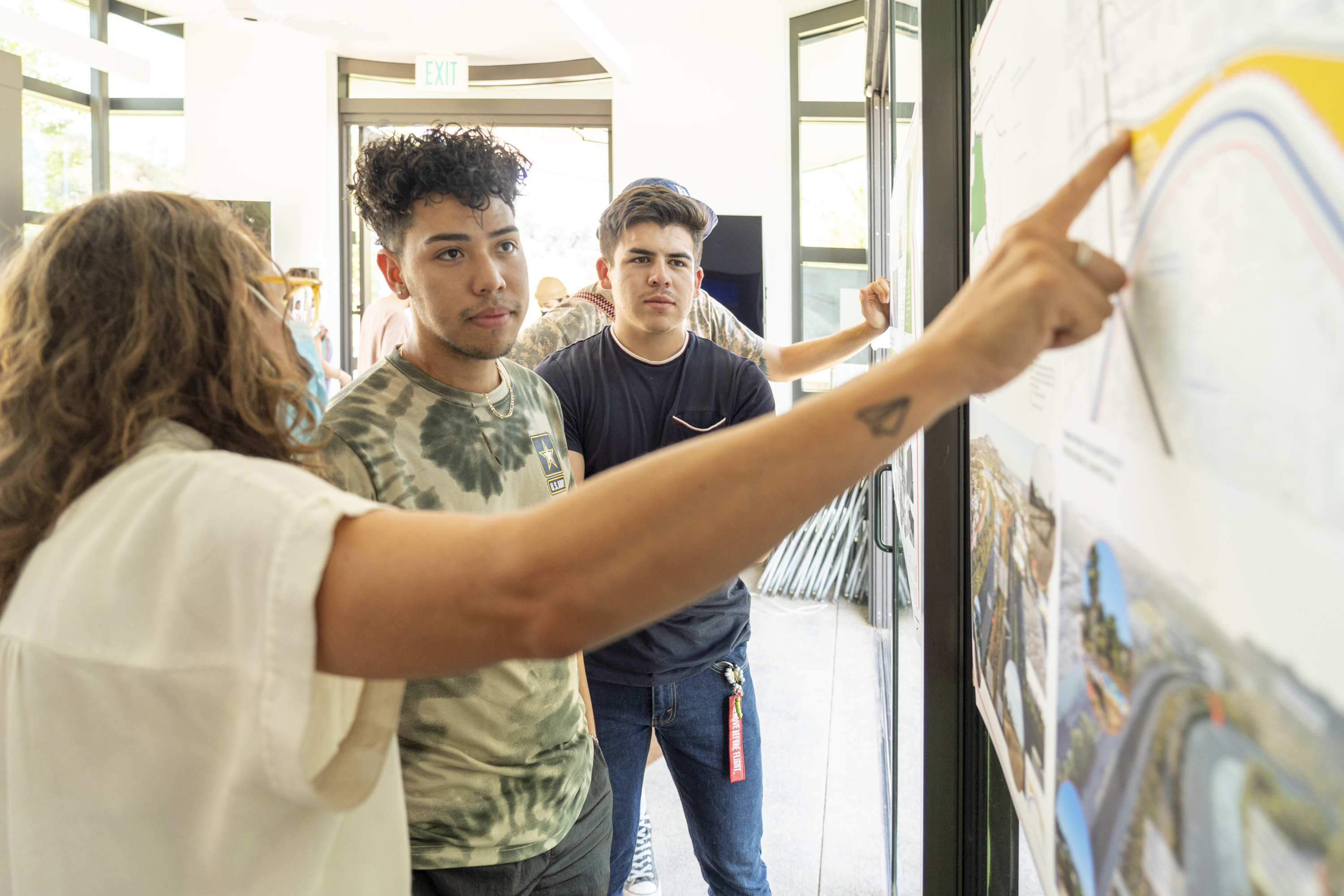
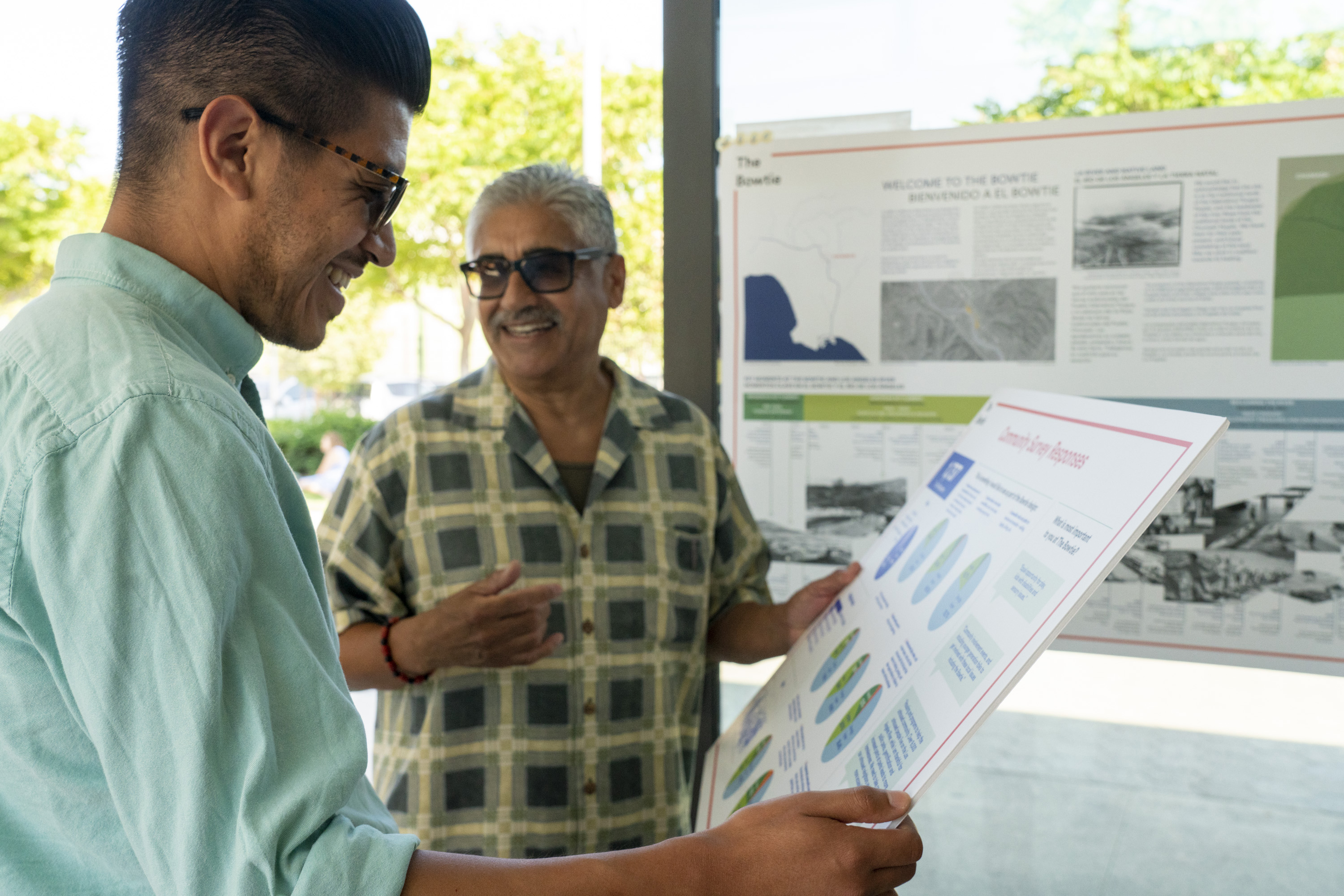
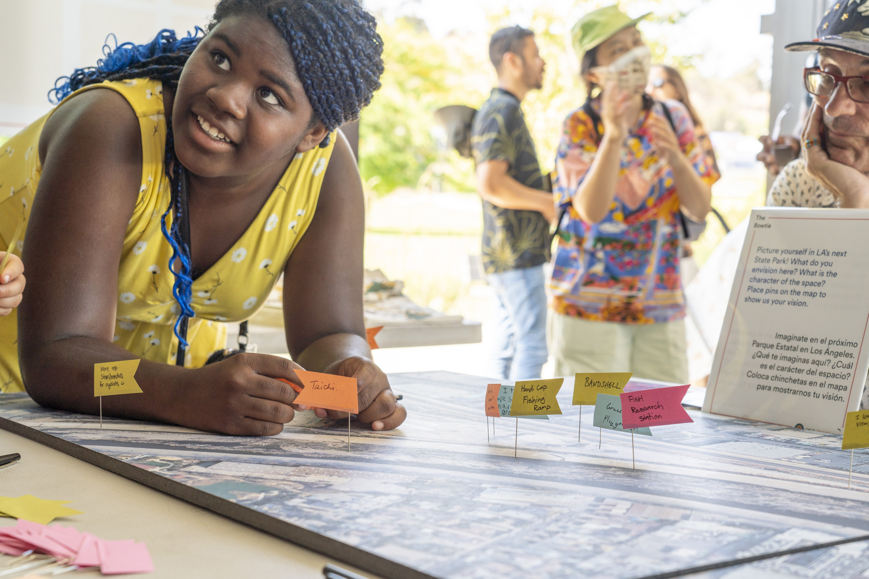
The success of the concept plan is the result of an extensive collaboration phase with local residents and community leaders. These events were held alongside other popular community events and festivals in the area, which allowed our team broader access to future park users by meeting them in their existing social spaces. Many events were formatted to invite neighbors into our design process - by using large-scale boards of the current site, participants could pin their preferred or expected uses and activities directly on the parts of the park where they would like them to be. This tangible collaboration method provided us with valuable community feedback and actionable measures.
The success of the concept plan is the result of an extensive collaboration phase with local residents and community leaders. These events were held alongside other popular community events and festivals in the area, which allowed our team broader access to future park users by meeting them in their existing social spaces. Many events were formatted to invite neighbors into our design process - by using large-scale boards of the current site, participants could pin their preferred or expected uses and activities directly on the parts of the park where they would like them to be. This tangible collaboration method provided us with valuable community feedback and actionable measures.


Pages from Analysis Presentation
Compiling Analysis and
Concept Plan Documentation
Our team takes great pride in understanding the many voices and perspectives that emanate from a particular place. We heard personal stories of spending cherished moments at the river’s edge, where the solitude and connection to nature provided an important refuge to the urban clatter that permeated most of their day to day experiences. Despite the concrete scar, the river is truly a sanctuary for local people, flora, and fauna alike, and with the right revitalization plan, it can become an even greater asset to all the lives that rely on its properties. This deep connection to the river resonated personally with our team and we felt a compelling drive to reflect this in our research and analysis report. From the history and stories we selected and the demographics we highlighted, to the colors and layout of the report and the personal hand-drawn illustrations by a member of our design team, we felt a responsibility to capture the soul and spirit of the place and the legacies it represented.
Our team takes great pride in understanding the many voices and perspectives that emanate from a particular place. We heard personal stories of spending cherished moments at the river’s edge, where the solitude and connection to nature provided an important refuge to the urban clatter that permeated most of their day to day experiences. Despite the concrete scar, the river is truly a sanctuary for local people, flora, and fauna alike, and with the right revitalization plan, it can become an even greater asset to all the lives that rely on its properties. This deep connection to the river resonated personally with our team and we felt a compelling drive to reflect this in our research and analysis report. From the history and stories we selected and the demographics we highlighted, to the colors and layout of the report and the personal hand-drawn illustrations by a member of our design team, we felt a responsibility to capture the soul and spirit of the place and the legacies it represented.